Visit my personal gallery at
Gardner Photography
for larger high resolution waterfall photos
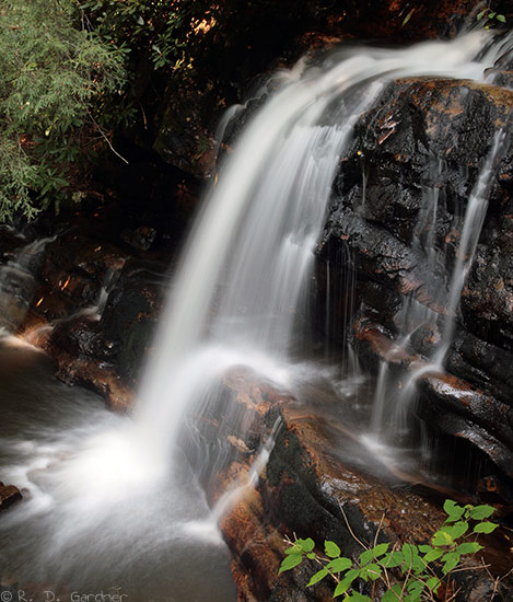
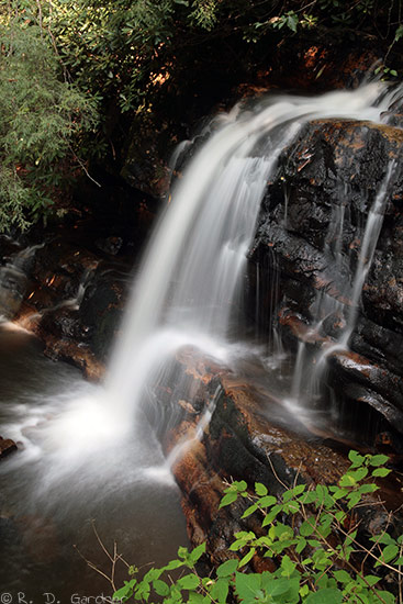
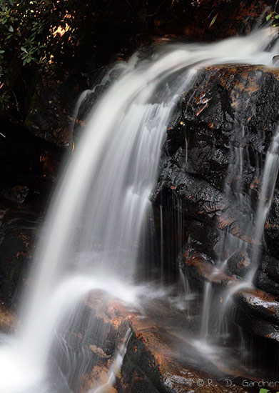
Straight Branch Falls
(8/07/2007, 33 mm, f/22, 2 sec, ISO 100)
Description
Straight Branch Falls received a 6 rating simply because it was an unexpected
delight. Right next to the highway, US-58, but not visible from the road
the waterfall is a little gem.
There are numerous points to photograph Straight Branch Creek as it parallels
US-58 for several miles on the way down the
mountain towards Damascus, VA. Cascades and small drops are in abundance
and I'm hopeful to come back next Spring.
Also nearby is both the popular Creeper Trail and the
Appalachian Trail.
Outdoor adventure does abound in the area. Between Whitetop and Damascus,
Virginia, the Creeper Trail follows several cascading mountain streams that can
be quite photogenic at times. Whitetop Laurel Falls is accessed via the
Creeper Trail.
From Damascus, VA, take US-58 East for somewhere around 6 miles. If you
see Feather Camp Rd or Bear Tree Gap Rd you've gone too far. Turn around
and look at your GPS. You do have one, right?
The waterfall and a pullout will be on the left side of the road. There
is no sign, no markings of any sort to indicate the location of the waterfall.
But I think if you use your eyes and ears you'll be able to spot it.
Hike Details
None.
Photo Tips
There's a fairly wide area behind the guardrail for walking and setting up a
tripod. Just don't let the really young ones over there.
To be honest, it was late in the day and I was tired so I picked what looked
to be a really good angle and shot everything from there. I didn't do much
scouting. Parking is slightly above the waterfall so I did see that the
high angle was bad but I didn't walk down the shoulder of the highway in search
of the perfect angle from below. The stream is not really accessible here
except by a billy goat so I took the easy shoulder shot.
Use a
polarizing filter for sure to help with
glare on the water and rocks.
The time of day was around 5:30 pm. No sun issues and it was a sunny
day. Because of the terrain just about any time but midday should be
mostly or completely shady and fine for photography.
Yes, I think a
tripod
is necessary unless you visit in the Spring and there is heavy flow. Even
then I would use a tripod. This waterfall begs for the silky smooth look.


New! Comments
Have your say about what you just read! Leave me a comment in the box below.