| ||||||||||||||||||||||||||||||||||||
The Cataracts
Andover North Surplus, Oxford, Maine
Visit my personal gallery at Gardner Photography for larger high resolution waterfall photos
The Cataracts
(8/4/2006, 21 mm, f/22, 1 sec, ISO 100)
Description
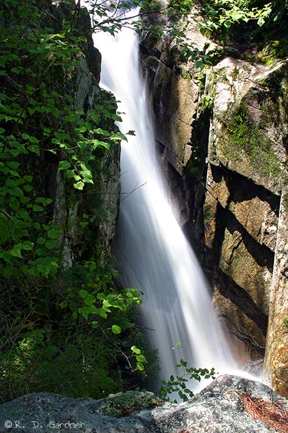
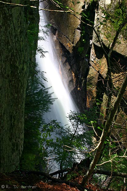
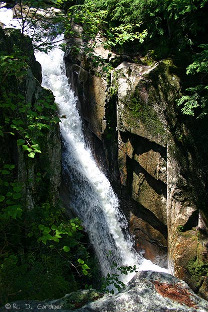
I'm afraid I won't be of much help with this waterfall, at least with the upper portion. I wasn't aware that this was a three-stage waterfall when I was there. I stopped at the lower falls pictured above. This is the major drop of the three, about 50 feet out of 90 feet total for the three. It was an impressive sounding waterfall in a narrow gorge area.
The hike is not difficult and it's a beautiful area so I say just go.
For pictures and more information on the upper falls go to this waterfall page, a great website.
Getting There
 To
be perfectly honest I remember having trouble finding E B Hill Rd - maybe
because it was also called Andover Rd?? - not sure. Anyway, technology is
great. I recommend you use the map below and get your own directions based
on the route/direction you'll be traveling. You can also use the GPS
coordinates listed on the left for The Cataracts to put in your GPS unit if you
have one. That should get you close too.
To
be perfectly honest I remember having trouble finding E B Hill Rd - maybe
because it was also called Andover Rd?? - not sure. Anyway, technology is
great. I recommend you use the map below and get your own directions based
on the route/direction you'll be traveling. You can also use the GPS
coordinates listed on the left for The Cataracts to put in your GPS unit if you
have one. That should get you close too.
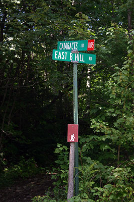
Also, for reference the sign picture (click to enlarge) to the left is the location of the hiking trail as it takes off from the road. There is a small pull-off nearby.
Use the following link to customize your own directions to The Cataracts.
View
The Cataracts in a larger map
Hike Details
The hike to The Cataracts is slightly up hill but not too strenuous.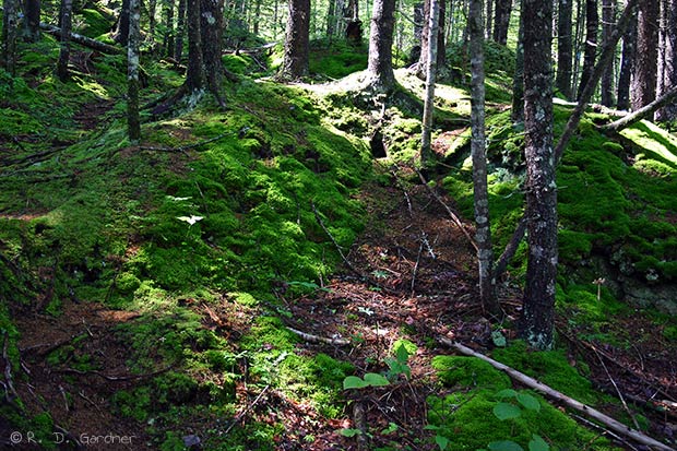 The distance to the lower falls, aka The Churn, (as far as I went) was about a
quarter-mile or so. The middle falls (known as The Cataract) are about 0.1
miles farther upstream and the upper falls (known as The Flume) is another 0.2
miles. ( middle and upper both unknown to me at the time, sadly)
The distance to the lower falls, aka The Churn, (as far as I went) was about a
quarter-mile or so. The middle falls (known as The Cataract) are about 0.1
miles farther upstream and the upper falls (known as The Flume) is another 0.2
miles. ( middle and upper both unknown to me at the time, sadly)
You will be hiking on the northern slope of Little Baldpate Mtn and it is relatively easy to see this with the abundance of moss in the area.
Photo Tips
SSun exposure was an obvious problem on the lower falls and will be most days. There is really no avoiding it here except to pray for clouds or arrive very early/late in the day.
You will need a good tripod to get long exposures. I played around with faster shutter speeds as you can see by the last photo on the left. It's a decent photo but I still prefer to blur my water - to each his own.
As always I recommend the use of a polarizer to cut down on reflections, expecially with all the granite in the state.
Composition - You are really limited by space. Most pictures will be portrait.
![]()
By Randy Gardner, All content Copyright© 2006-2016, All rights reserved.
No unauthorized reproduction is allowed.
Pictures may be used for private use only with permission from author. Contact Us
New! Comments
Have your say about what you just read! Leave me a comment in the box below.